So this time of year as we're in March with the weather changing (warmer, colder, rain) and in MS the start to our Spring Severe Weather Season. You can't help but remember the phrase "March comes in like a lion, and goes out like a lamb!"
The National Weather Service in Jackson, MS has issued a Flash Flood Watch (auto-update graphic attached) for much of the Central MS Area. Widespread 2" rainfall totals are expected, with some area's could see 3-4" of rainfall between today and tomm morning:
Now, the heavy rainfall is pretty much a guarantee. What's not completely clear (as of the noon writing of this on tuesday), is the severe weather outbreak that will also be a part of this system. It certainly seems that the further south you go in the Gulf Coast Region the higher the chance for a possibly significant severe weather outbreak is possible. What's unclear at this hour is: 1.) How far North the severe weather threat/outbreak might materialize 2.) the exact timing on the storms 3.) the magnitude of the outbreak as/if it materializes.
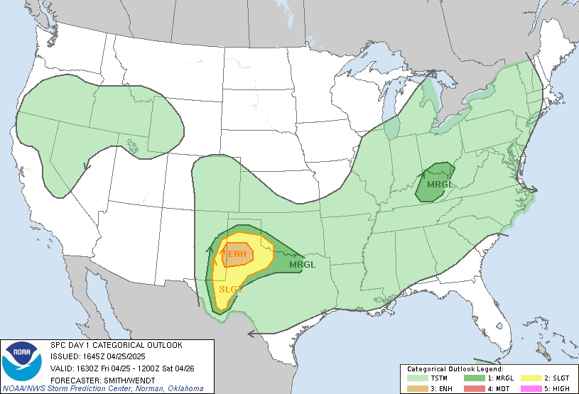
The Storm Prediction Center is the national agency charged with the responsibility of monitoring the country for dangerous weather outbreaks, as well as issuing all the tornado/severe thunderstorm watches. They have (auto-updating graphic) placed parts of Central/South MS & LA under a Moderate risk of severe weather.
There's 3 categories: 1.) Slight, 2.) Moderate, 3.) High; you usually see a high risk issued only maybe a couple times a year. The Moderate risk for Tuesday is due to the confidence is growing that somewhere in the region we could see a severe weather outbreak with strong-violent as well as long tracked tornadoes.
When you put all this together, here's a map (auto-updating graphic) indicating the breakdown of possibly hazardous/severe weather across the region:
Now With Any Weather Situation: 1.) Heavy Rain, 2.) Winter Weather, 3.) Severe Weather it's an always evolving and sometimes quickly evolving situation!! My posts/blog is an attempt to break this situation down for you, and let you see what's out there. It's always imperative to stay tuned to local tv, emergency management, and NOAA weather radio to monitor for weather updates!!
I would imagine to see severe weather watches be posted for our area as the day/evening moves along. While there might be a strong thunderstorm (gusty winds 40-50 mph, small hail, etc) earlier in the day, it's expected that much later in the afternoon-evening that the severe weather threat will unfold.


